

Enter an address in Google Maps, tap Directions, and follow the blue dot to your destination. It reliably gets you from point A to point B.
However, I’ve noticed that the moment people try something different, like adding a stop for another passenger or wanting to pre-plan their arrival time, they often panic.
The tools to handle these situations are already built into Google Maps, but most never explore them. Behind the simple interface are tools that save time and improve your planning.
Here are seven tricks every user should know. Learn them, and you’ll no longer need another Navigation app.
7
Plan your day in Maps without backtracking
![]()
Source: Lucas Gouveia/Android Police
You have a busy Saturday ahead. You must visit the post office, the dry cleaner, the grocery store, and a friend’s place.
The typical approach is inefficient. People usually navigate to the first stop, finish, then enter the next address.
You are repeating this all day, possibly backtracking across town. However, you can plan your route before you leave.
Google Maps lets you add up to nine stops plus your starting point to one trip. Enter the first destination and tap Directions.
Tap the three-dot menu at the top right and select Add stop. In the new field, add the next location. Repeat until the itinerary is complete.
Now optimize the order. By default, Google Maps follows the order you entered, which can be inefficient.
You can manually reorder the stops. Each stop has a handle with horizontal lines. Tap and hold to drag stops into a logical geographic order.
Use this for any day with more than two stops. It works for a day of errands, a road trip with planned stops, or a sales route with client visits.
6
How to plan around rush hour with Google Maps
Source: Lucas Gouveia/Android Police
You have a work meeting across town tomorrow at 9:00 a.m. You check the route overview, and it shows 30 minutes.
But what will traffic look like at 8:00 a.m. on Tuesday? Guessing leads to stress and delays.
Google Maps includes an underused feature that estimates travel times based on future traffic patterns.
After you set a route (single destination only), don’t stop at the current ETA. Open the three-dot menu and select Set depart or arrive time.
Choose Depart at to see how long the trip takes if you leave at a specific time. Select Arrive by to have Maps tell you when to leave so you can arrive on time.
Google Maps uses historical traffic data to forecast times and shows color-coded bars that visualize how conditions change throughout the day.
Test different departure times. Sometimes, leaving 15 minutes earlier — like before rush hour, the school pickup line, or before the stadium traffic builds — can save you half an hour or more on the road.
5
How to navigate when cell service drops out
Cell coverage is spotty at best in the mountains or inside a national park. If Google Maps quits unexpectedly, or you swipe it away by accident, your directions disappear right when you need them most.
The same issue occurs when traveling internationally, where mobile data is expensive.
Google Maps lets you save large map areas to your phone for offline access. When online, search for a city, county, or region. Tap the place name at the bottom, open the three-dot menu, and select Download offline map. Pinch and zoom to define the area to save.
To manage offline maps, tap your profile picture in the upper-right corner and open Offline maps to update, rename, or delete maps.
Live features like public transport directions, traffic information, or alternative routes are unavailable when you’re offline.
4
Let Google Maps find essential stops without detours
![]()
Source: Lucas Gouveia/Android Police | EKA UDALTSOVA/Shutterstock
The fuel light comes on two hours into a long road trip, and your caffeine is low. You need a gas station and a coffee shop, but you don’t want to detour into an unfamiliar town for 15 minutes.
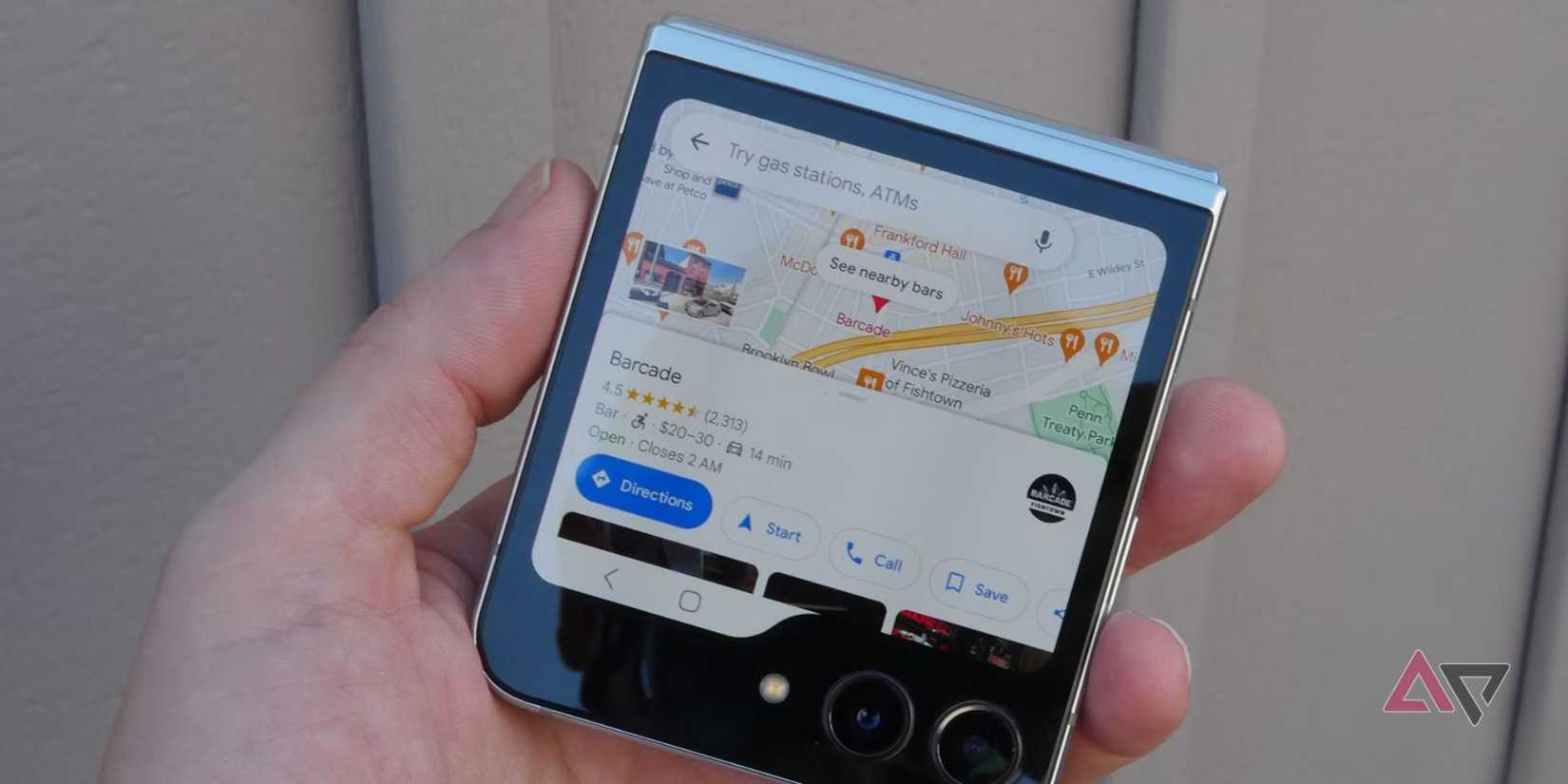
Google Maps supports searching within your current trip. While in active navigation mode, a set of new options appears. Tap the magnifying glass icon on the right. Choose gas stations and restaurants, or type a custom search.
Google Maps shows results on your route and tells you how many minutes each option adds to your total travel time.
A gas station right off the highway might add only two minutes, while one a few blocks into town might add eight minutes.
This turns guesswork into a quick, data-driven choice, letting you pick the most efficient option without breaking your rhythm.
3
Create a personal guide inside Google Maps
Source: Canva/Android Police
Over the years, you’ve probably starred hundreds of places. Your map becomes a field of identical yellow stars, which makes it hard to use.
It’s time to replace generic stars with custom lists. Custom lists are one of Google Maps’ most powerful organizational features.
Open the Saved tab, then select New list under Your lists. You can create lists for anything. Some of mine are weekend trip ideas, local hikes, and restaurants to try.
When you find a place to save, tap Save and choose a list. Add notes to entries and assign a unique emoji to each list so they show different icons on your map.
You can also share lists. Send a view-only link to friends visiting your city, or share an editable list with travel partners to build a collaborative itinerary.
This feature is also ideal for travel. Create a shared vacation list with a partner to keep everything organized.
2
Use Google Maps to remember your parking location

It’s the end of a long shopping day. You step into a multi-level garage or large lot and realize you don’t know where you parked.
Let Google Maps remember for you. It takes five seconds and prevents the where did I park dilemma.
After you park, open Google Maps and tap the blue dot for your location. When the menu appears, tap Save your parking. A P icon marks the spot on your map.
Add context to make it more useful. Tap the parking label to add notes (for example, Level 3, Aisle G), add a photo of a nearby landmark, and set a timer to remind you before the meter expires.
Some phones do this automatically when they disconnect from your car’s Bluetooth.
1
Use your camera and AR to find your way indoors
GPS gets you to the front door, but often struggles in the last 50 meters. You come from a subway station with four possible exits, unsure which way to turn.
Live View is Google’s augmented reality (AR) feature. You’ll see a Live View button when you select walking directions. Tap it, and the app will overlay arrows and labels on the scene to point the way.
It uses AI and machine learning to match your camera view with Street View imagery to determine your location and orientation. It also works indoors.
In supported airports, malls, and train stations, Live View guides you through the building to your gate, baggage claim, a store, or the nearest restroom when GPS doesn’t work.
Google Maps is more than a blue dot navigator
At the end of the day, we all want to get to where we’re going without headaches.
With these eight tricks, you will spend less time fumbling with your phone and more time enjoying the ride.
Next time you open Google Maps, remember it can do much more than follow the blue dot.